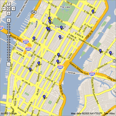
The following picture shows the location of Super Shuttle’s fleet at the time of this posting.
The search giant Google is tracking participating shuttle and taxi services using technology from their Google Maps. So far the list of participating cities is small and even then the services within each city is limited, but I’m betting this will catch on – BIG TIME. In New York, as pictured here for example, these marked points represent the locations of each of Super Shuttle’s vehicles.
I think this concept is great, are other real time services just around the corner? When does all this easily accessible information become “too much information”?
In other Google news, it’s been a year to the day since Google announced Gmail and in a continuing effort to keep everyone happy with the free service, they are now offering 2GB of free storage for their web based email service. Happy April Fool’s Day!
